The Augmented Vision department presented 3 publications at the 33rd European Signal Processing Conference (EUSIPCO 2025), held in Isola delle Femmine – Palermo – Italy, on September 8-12, 2025.
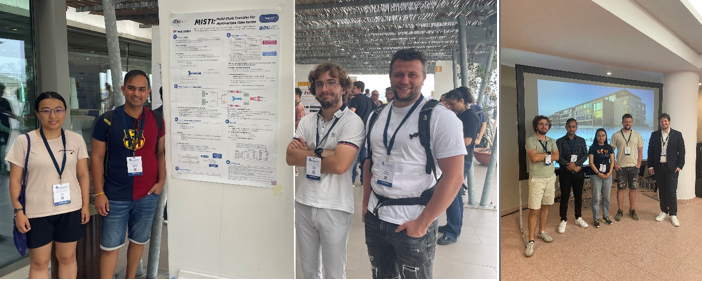
The 3 presented publications were:
ParticleSAM: Small Particle Segmentation for Material Quality Monitoring in Recycling Processes, Yu Zhou, Pelle Thielmann, Ayush Chamoli, Bruno Mirbach, Didier Stricker, Jason Raphael Rambach
A Multi-Camera Vision-Based Approach for Fine-Grained Assembly Quality Control
Shashank Mishra, Ali Nazeri, Achim Wagner, Martin Ruskowski, Didier Stricker, Jason Raphael Rambach
MISTI: Multi-Style Transfer for Multivariate Time Series
Henri Hoyez, Bruno Mirbach, Cedric Schockaert, Jason Raphael Rambach, Didier Stricker
Contact: Jason Raphael Rambach


